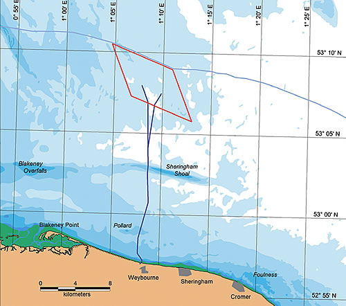
Location
The Sheringham Shoal Offshore Wind Farm site is located in the Greater Wash, between 17 and 23 kilometres off the Norfolk coast, north of the seaside town of Sheringham. The site was chosen because it:
- lies within a government approved area for development
- enjoys high wind speeds
- has favourable water depths
- has relatively low levels of fishing activity
- affords good access
- has grid connection options
- is outside protected and scientifically designated areas.
Wind energy in Norfolk is not a new idea. In the past, wind blowing freely over the area’s flat landscape pushed the sails of windmills to grind corn into flour. Out at sea, where the wind blows stronger still, fishermen used the wind to propel their boats. The same strong sea winds that once filled the sails of former fishing boats now turn the blades of wind turbines to generate electricity.
Coordinates of the wind farm site in WGS84 format
| Point | Latitude (N) | Longitude (E) |
|---|---|---|
| 1 | 53° 10.4788' | 01° 4.6665'; |
| 2 | 53° 8.9810' | 01° 10.9461' |
| 3 | 53° 5.7867' | 01° 13.0289' |
| 4 | 53° 7.2916' | 01° 6.7490' |